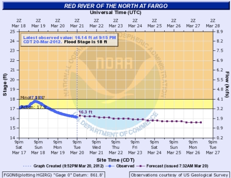
(Almost) Wordless Wednesday: Most beautiful hydrograph in years March 20, 2012
Posted by mareserinitatis in Fargo, geology, science.Tags: fargo, flood, red river
add a comment
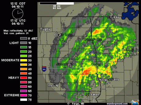
Big red splotch headed toward Fargo April 10, 2011
Posted by mareserinitatis in Fargo.Tags: 2011 flood, fargo, red river
add a comment
The river hit a crest of about 38.75 feet yesterday and has dropped 0.2 feet overnight. Unfortunately, it’s looking like we’re going to get some rain (the red blob to the southwest is headed right for us). Supposedly this won’t increase the river level but will keep it at its current level for longer than we’d like.
Additionally, there is a lot of overland flooding in the rest of the county, including Interstate 29.
Pictures of the Red River April 9, 2011
Posted by mareserinitatis in Fargo.Tags: 2011 flood, erosion, fargo, North Broadway, red river, Trollwood
add a comment
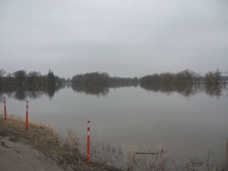
I took a walk to North Broadway to get some pictures of the flood. This is about a mile from my house, a place I go often because my favorite biking trail is here. Currently, however, it’s submerged.
This is near where the trail starts. As you can see, they don’t want people walking on the dikes. To the left, off camera, is a lift station. While we were there, a Fargo City worker came to check on things.
The New York Times also had an interesting article on the different types of flood fighting measures they’re using this year, reducing reliance on sandbags.
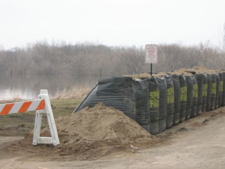
This is a trapbag dike on the road between Trollwood Park and North Broadway. The road is closed to traffic because erosion has eliminated the structural integrity of the bank. They used to try to maintain the bank, but abandoned it a few years ago.
This picture shows you a path that used to travel along the bank, giving you some idea of how much erosion has occurred. Also, so that you realize how much water is here, the bank slopes normally drop down about 20 feet and there is an almost flat area right next to the river where people go to fish during the summer. The whole slope is under water now.
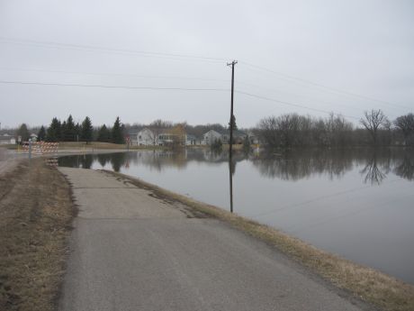
This is the bike path, and it follows the road, turning to the right about where the barricades are.
If the barricade isn’t enough of a deterrent, a curving road underwater ought to be.
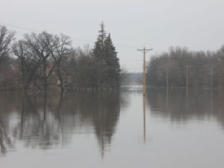
You can see two paths through the trees. The path on the right is where the river normally flows, and the path on the left is the road with a bridge to the Minnesota side.
You can see the barricades on the Minnesota side of the river through the trees. And the houses on the left are normally a good ten feet above the road.
I’m hoping to go out tomorrow and take more pictures at a different location, but that will depend on time and accessibility. No one seems to mind people taking pictures, but it’s hard to get to a place where you can take good pictures without climbing a dike.
Only 39.5 feet April 7, 2011
Posted by mareserinitatis in Fargo.Tags: 2011 flood, flood, oak grove, red river
add a comment
The news, before we had some rainshowers this morning, was that the Red may only hit 39.5 feet when it crests.
Only.
This could be the third highest crest in over a century, and we’re all relieved that it’s not going to be first…even though, in reality, they’re saying it could be up to 41 feet, which would put it in first place.
I was driving around yesterday, and the river is flooded pretty badly. I saw someone’s chicken coop mostly underwater, and there are a lot of houses that look like they’re in danger. At that point, it was at 32 feet, so it still has about 7 feet to go. Now it’s up to 35 feet, 12 hours later.
In the meantime, someone took a video of the Oak Grove campus today. Oak Grove suffered damage in ’97 and added a permanent diking system around the school. A couple years ago, during the record flood, there was a problem and the diking system failed. Let’s hope it holds out this year. The video was taken was the water was still four feet below the crest:



 I also blog at Engineer Blogs, home away from home to some of the best engineering blogs.